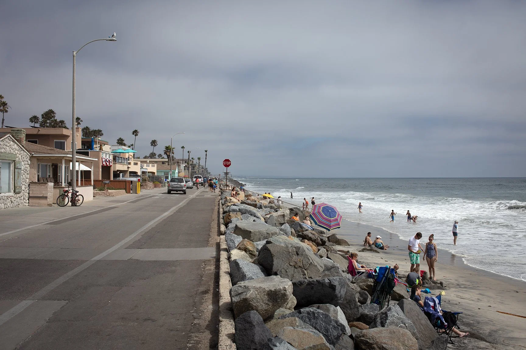
Here’s a photograph of the Oceanside Strand from July 2019. A lot of the shoreline south of the pier is protected by this kind of riprap.
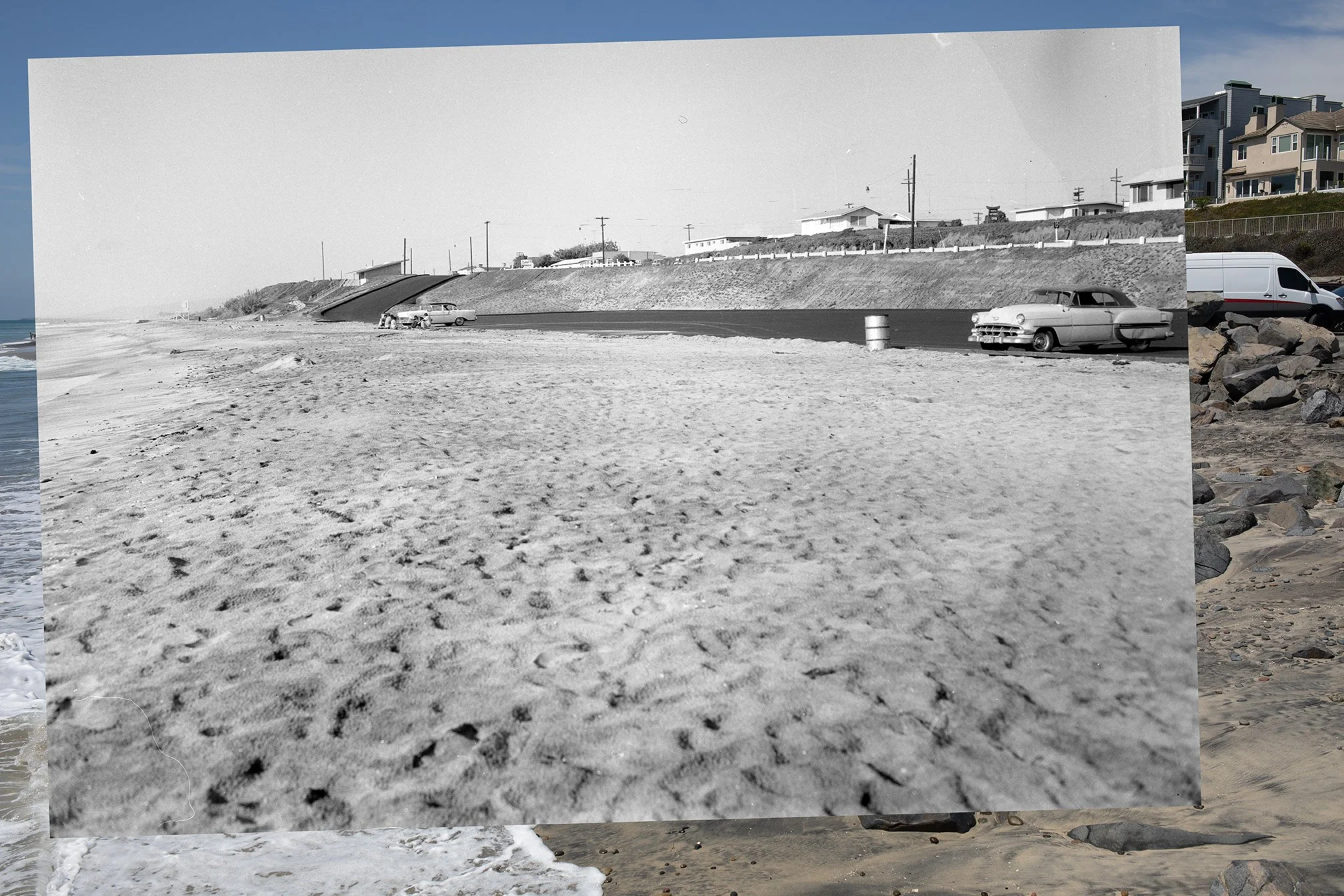
Composite image of the Tamarack Beach parking lot, showing the photograph from 1959 overlaid on the photograph from 2026.
Tamarack Parking lot in 1959 and 2026
Here’s another photo from my recent trip down the Southern California. I headed down in part because my old home beach of Tamarack was in the news. Check out some of the coverage via the SF Gate here, and NBC7 here.
Long story short, high tides and large waves from a summer south swell swept a lot of sand off the beach at Tamarack. It also undermined the riprap that was protecting the parking lot. In some of the coverage, people express concern about the loss of sand from the beach. Others say that this is how the beach actually used to look years ago.
Read More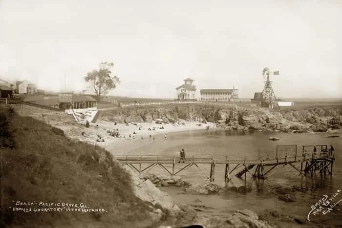
Location Scouting: Lover's Point, Pacific Grove CA
File this one under early modifications of the California coast. People have been finding ways to alter and modify the shoreline for a long time. Here’s an example from Pacific Grove, California. The photo above shows Lovers Point Beach in 1903, taken by Clara Sheldon Smith (via the Hathaway Collection). Notice the wooden “wharf” in the foreground. This is the second wharf, which was built in 1897 by a guy named William Hatch (see the Pacific Grove Historical Context statement). Apparently Hatch blasted rocks from the beach and cliffs to build the new wharf. The first wharf was built in 1890 but it was destroyed by storms within just a few years. This fits the general story of construction, destruction, and reconstruction up and down the coast.
Here’s another image of Lover’s Point from 1910, taken from a different direction. This was taken by M. Rieder (via USC’s Calisphere archive):
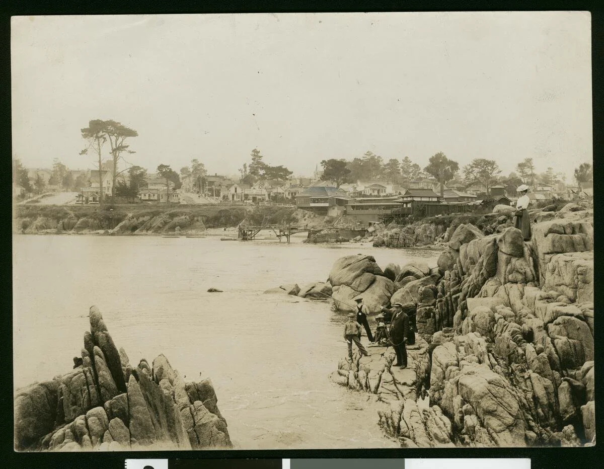
1910 photograph of Lover’s Point by M. Rieder. Here’s the description via Calisphere: “Photograph of a view of Pacific Grove, Monterey, from Lover's Point, ca.1910. Several people look onto the water at left from the rounded rocks on the right. A few boys fish while a man in a suit points towards the left. A woman in a dress and hat stands at top on the far right. A town of buildings, houses, and tree-lined streets stands on the far bank in the background.”
I was down in Pacific Grove last week and had a chance to see Lover’s Point briefly. There’s a concrete pier/boat launch structure that was added at some point after the two wharves—I need to look into those histories a bit more. I didn’t get a chance to photograph it because I was busy…chasing two kids around. I’ll have to get some photos next time we’re down that way. This is another good candidate for the coastal rephotographic project, since there’s a number of historical images to work with.