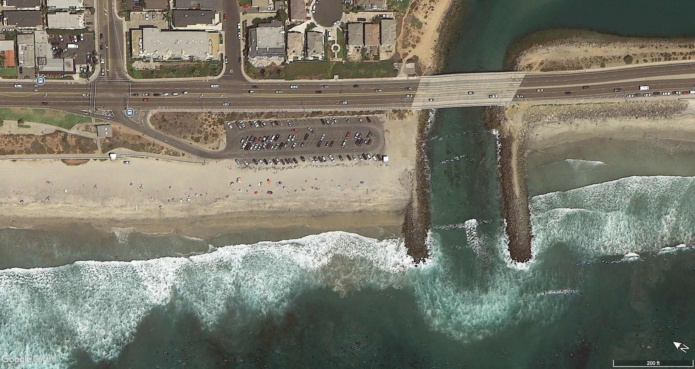
Here’s a follow up to my last post about sand loss at Tamarack. The Google Earth image above is from August 2010. Notice all that sand on the beach! The sand fill extends more than half way of the jetty. Now here’s how the Tamarack looked in August 2019:
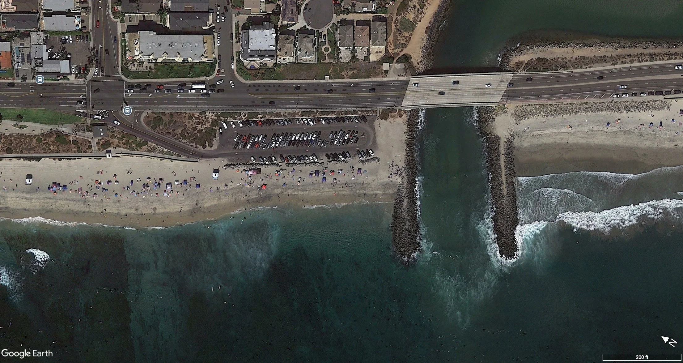
Google Earth image of Tamarack State Beach in Carlsbad, California. August, 2019.
Here’s August 2021:
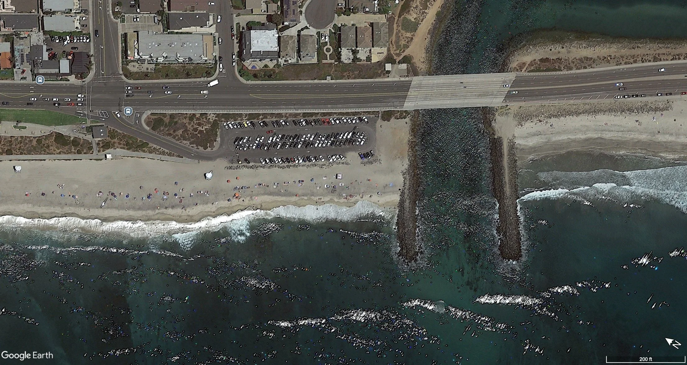
Google Earth image of Tamarack State Beach in Carlsbad, California. August, 2021.
And finally here’s how Tamarack looked from the air on August 1, 2026:
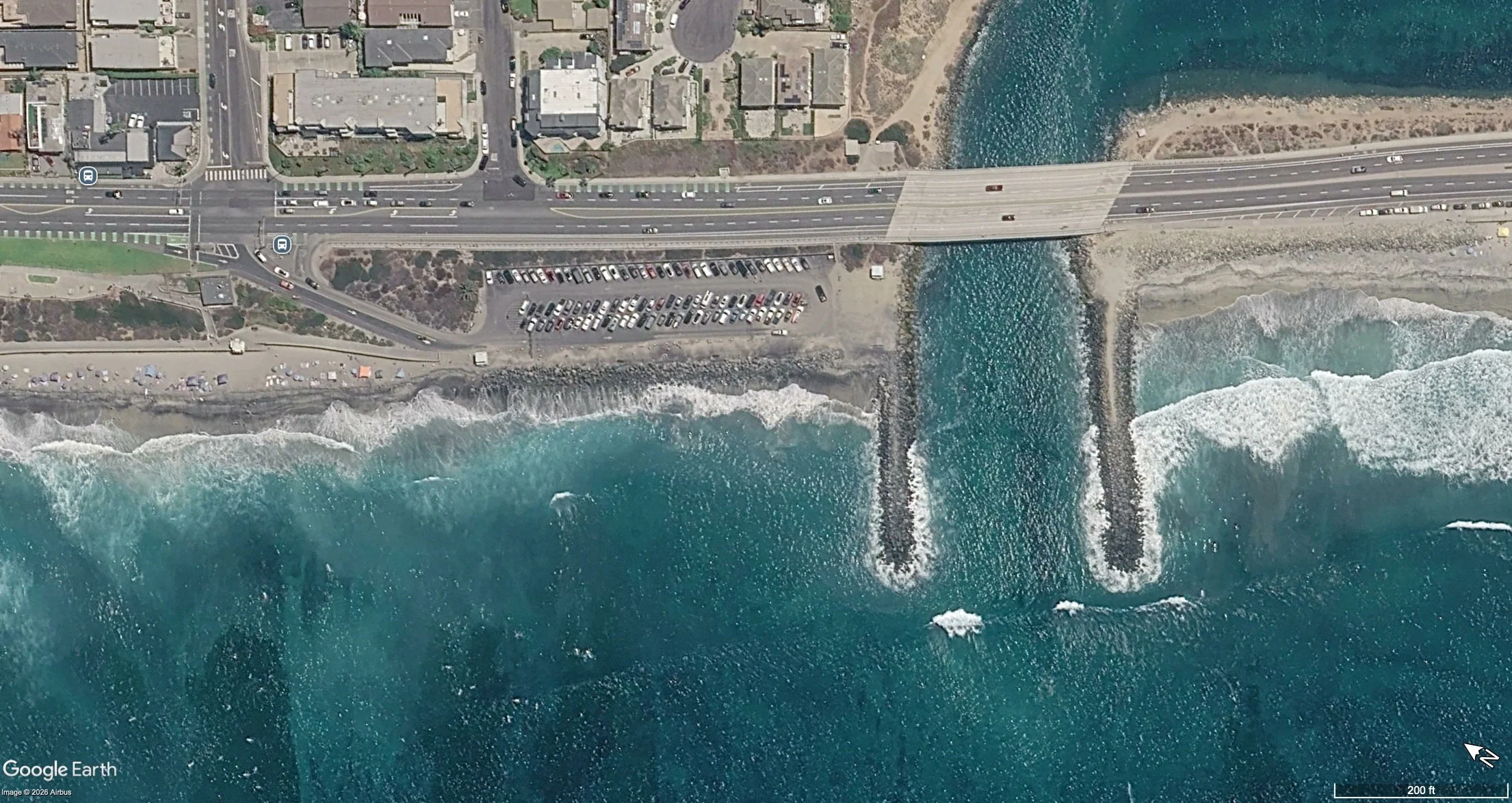
Google Earth image of Tamarack State Beach in Carlsbad, California. August, 2026.
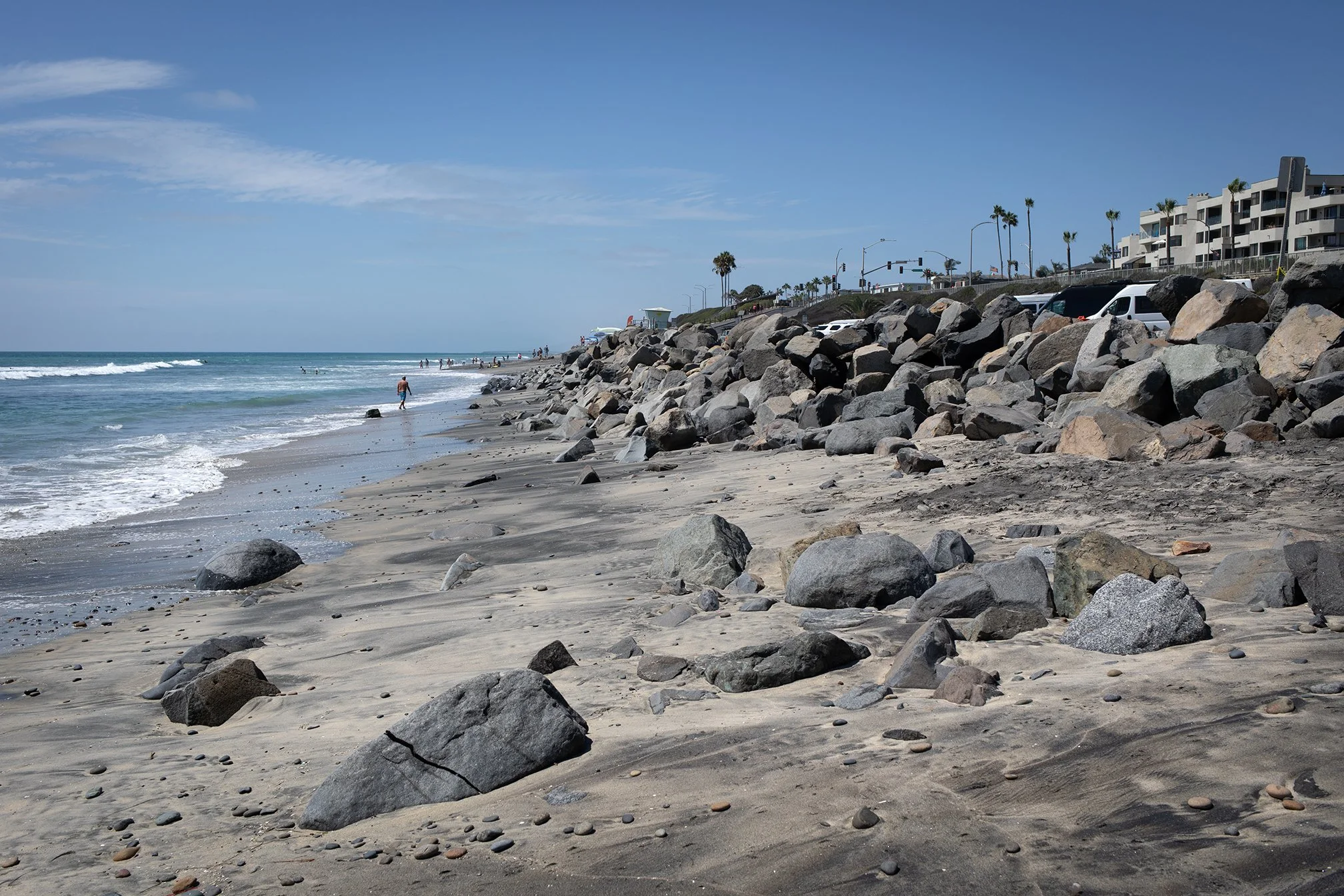
There’s a certain amount of fluctuation in all the images, which is to be expected. But the last image, from 2026, shows a much more severe level of sand loss (which I have also shown in some other posts). Notice how much of the jetty is now exposed and how you can see all the riprap (unlike the other images above). For years, sand has covered over the riprap and extended the beach much further out. Looking at the 2026 image above, you can see that all of this sand has been pulled back, the beach is shorter, and all that riprap has been exposed. Here’s how this looked on the ground (image taken from near the north jetty, facing northwest):