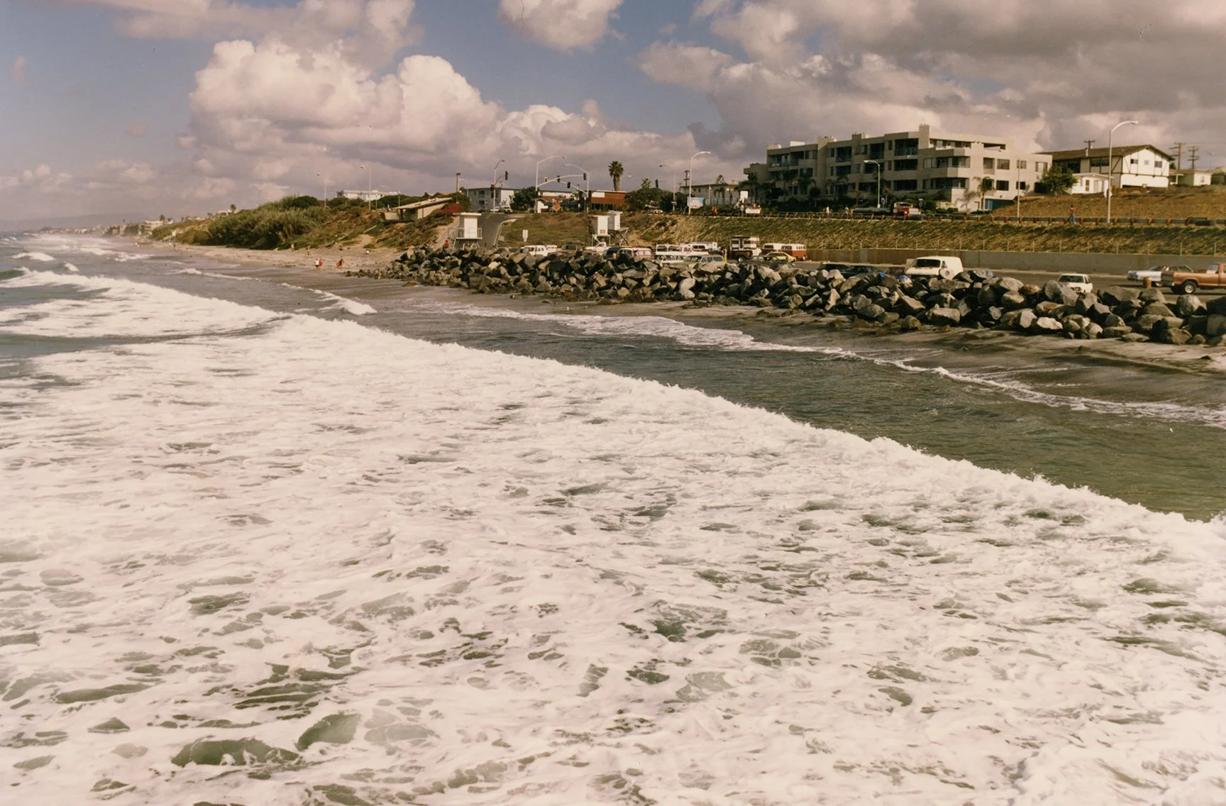
Sometimes it’s a little hard to judge sand loss at a given location. With the sand loss event at Tamarack in Carlsbad this past month, what effectively happened was the return to how the sand and beach looked before the extensive sand replenishment that started in the early 2000s. The image above, which was taken before the seawall was constructed in the late 1980s, shows the beach and parking lot. Notice that the parking lot was already protected by riprap at this time. Here’s another image from after the seawall was constructed (circa late 1980s to early 1990s):
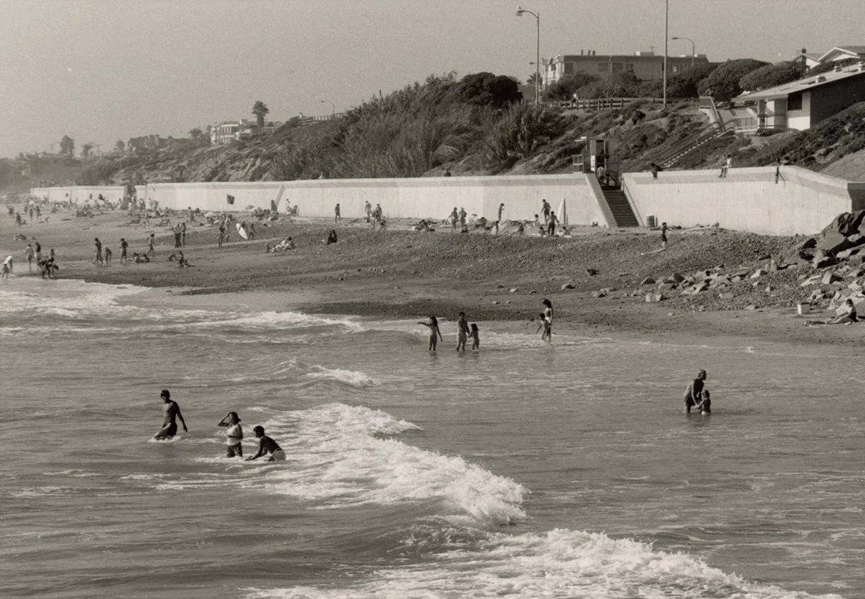
Tamarack State Beach, circa the late 1980s to early 1990s. As with the first image above, this one was shot from the northern jetty at Tamarack. It was shot with a longer focal length, so it shows a more closeup view of the beach. If you look above the end of the riprap wall in the first image, you can see how it looked before the seawall. This photo shows how the beach and bluffs looked after the seawall was put into place. Notice all the cobbles on the beach, and the relatively short beach. As generally happens with such structures, the seawall resulted in passive erosion and beach loss, which subsequently led to numerous sand replenishment projects.
In this image you can see the end of the riprap that protected the parking lot on the far right side of the frame. I spent a lot of time at Tamarack in the late 1980s through the 1990s. Just to provide a better idea of how they fit together, here’s a composite with the more recent image overlaid upon the older image:
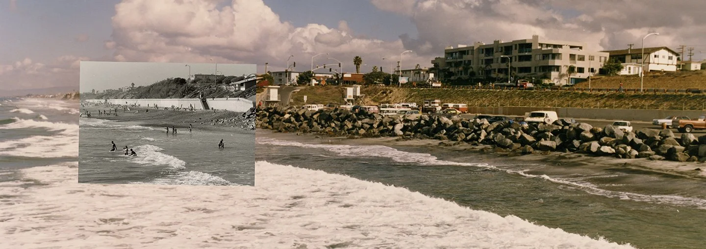
Composite image showing the newer image (post-seawall) overlaid on top of the older image from the early 1980s.
Both of these images provide a good idea of how the beach looked during that time. Tamarack had a modest amount of sand. As depicted in the second image, it tended to have a lot of cobbles, especially at certain times of the year. Anyone who spent time at Tamarack during those years will remember all the rocks. And as I remember it, the beach in front of the riprap and parking lot tended to be quite short (due to passive erosion, which comes hand in hand with these kinds of structures). Here’s what this beach looked like in March 2018:
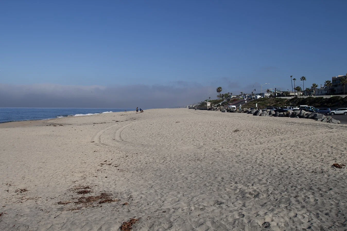
View of Tamarack State Beach in March 2018. Notice the wide sandy beach. This one was shot with a slightly wider angle lens, which exaggerates the foreground a bit. But it’s still very clear that the beach was much wider and there was a lot more sand after replenishment. Photo: Ryan B. Anderson.
This image was taken from a similar position, out near the jetty, as the first image above. Notice the length and angle of the beach and how the sand is even with the upper layer of the riprap wall. This kind of beach was the result of years of consistent sand replenishment. It resulted in a very different beach profile and impacted how the waves broke at Tamarack as well. It makes sense why State Parks and the City put all this sand on the beach: it makes a lot more space for tourists and beachgoers.
For comparison, here’s how things were looking after the sand loss event of August 2026:
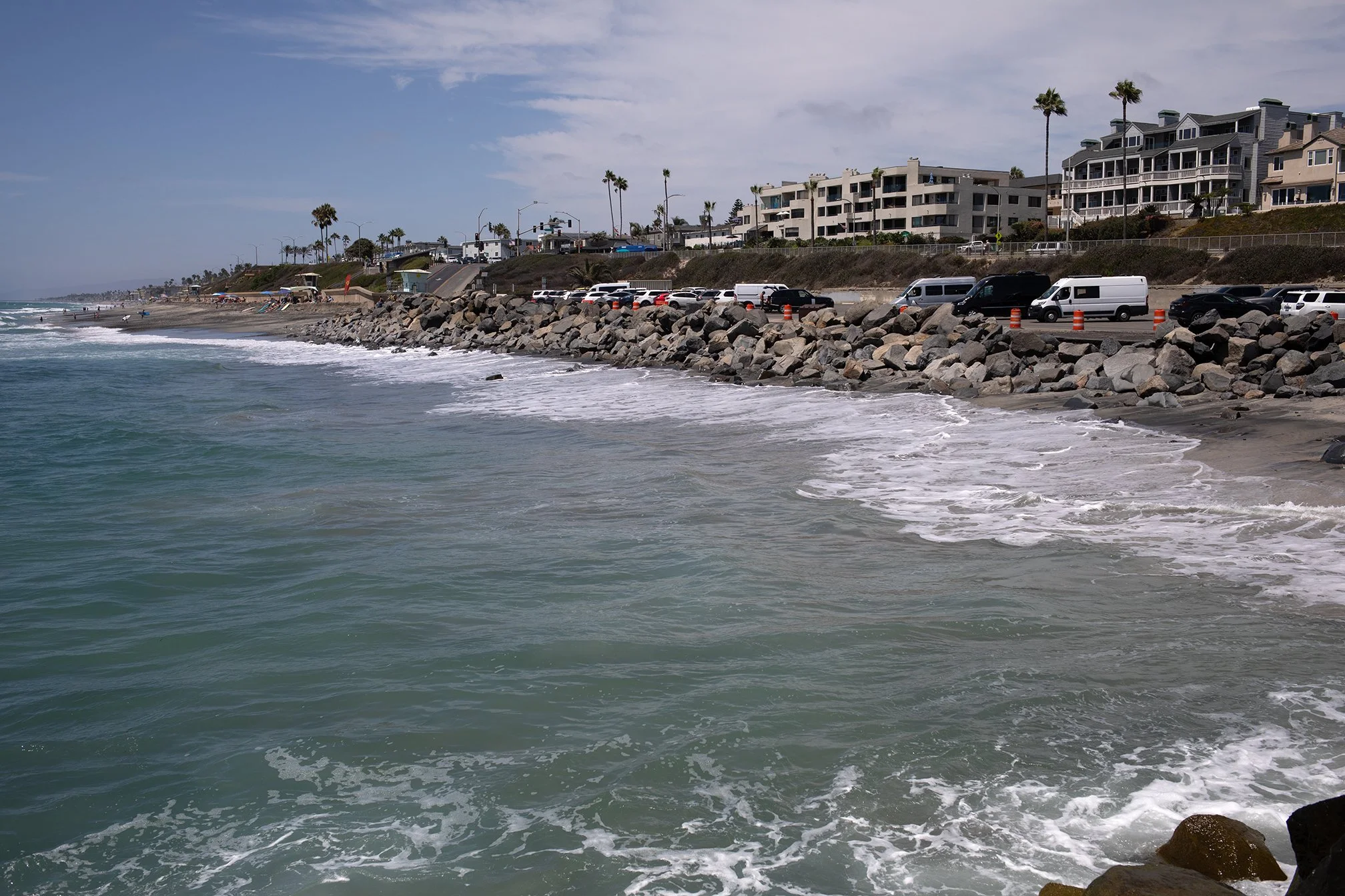
View of Tamarack State Beach in August 2026 after a large sand loss event. Notice how the sand in front of the riprap wall has been pulled away and there is almost no beach in front of it. This sand loss event resulted in a beach that looks similar to what was common in the 1980s and 1990s. Photo: Ryan B. Anderson.
In this more recent photo, the beach actually looks a lot more like it did in the early 1980s and 1990s. All of the sand that had been pumped onto the beach was stripped away by high tides and south swells (the jetties help retain sand for most of the large winter swells, which tend to come more from the north and west).
I need to work on getting some better, more direct comparisons to illustrate all of this. That will make it easier to see all the changes. I just found that 2018 image this week while looking through some of my older files. It would have been nice to have had that one with me during the last trip.
One very interesting aspect of all this is how people can normalize certain conditions in a landscape. This seems to have happened with some folks who have been going to this beach in the last 20 years who see all the replenished sand there as ‘normal’ or ‘how things are supposed to be.’ Given that context, it’s easier to understand why many people want to immediately pump more sand onto the beach after a sand loss event. For them, that’s how things have been and should be.
What many folks don’t know, however, is that the beaches they ‘know’ are often the result of a lot of management, intervention, and engineering. This is definitely the case with Tamarack, and a more historical view can help shed light on the overall situation. The beach that is now Tamarack State Beach was once just a bit of bluffs and sand at the mouth of the Agua Hedionda lagoon. The lagoon mouth opened and closed periodically, as is the case with these kinds of systems, depending on conditions. Tamarack started to change as more engineering came into play, including the construction of the coast highway in the early 20th century, the creation of the parking lot sometime in the mid 20th century, construction of the jetties in the 1950s (I think), and the construction and completion of the Carlsbad Sea Wall in the late 1980s.
Combined, these structures resulted in certain expected outcomes, including passive erosion and beach loss over time. The sand replenishment projects that came later were a down-the-line result of all those changes (plus additional complicating factors such as sea level rise). This is a bit of a rough outline of one project I’m currently working on, which is an environmental history of this one little beach that I happened to know pretty well for a couple of decades of my life. More updates on that soon.