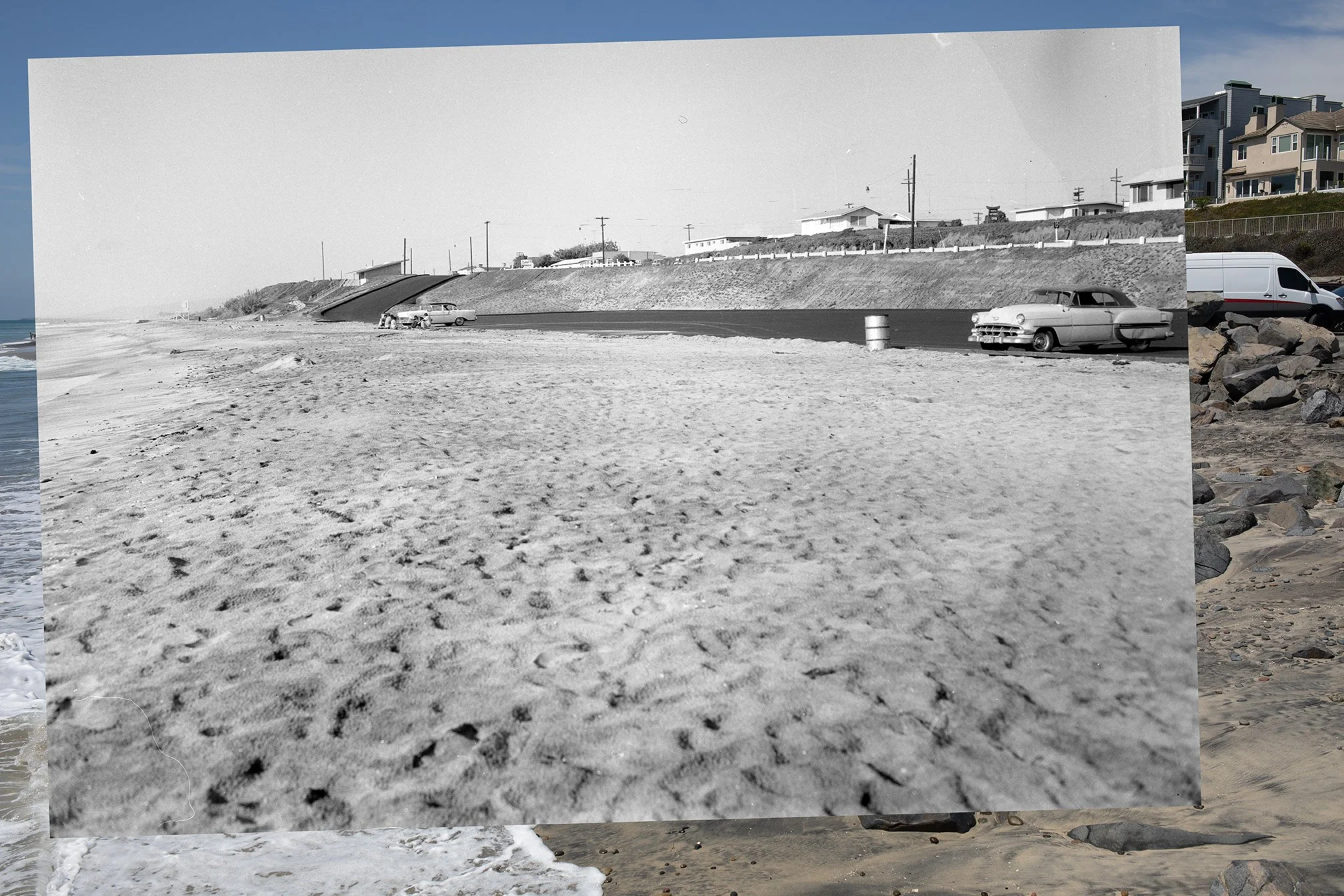
Here’s another photo from my recent trip down the Southern California. I headed down in part because my old home beach of Tamarack was in the news. Check out some of the coverage via the SF Gate here, and NBC7 here.
Long story short, high tides and large waves from a summer south swell swept a lot of sand off the beach at Tamarack. It also undermined the riprap that was protecting the parking lot. In some of the coverage, people express concern about the loss of sand from the beach. Others say that this is how the beach actually used to look years ago.
As someone who grew up surfing at Tamarack in the late 1980s and throughout the 1990s, I can attest to the fact that the beach does indeed look different today. The sand loss from summer 2026 did in fact make the beach look more like what it did about 40 years ago (as someone in the NBC piece mentions). But a lot of more recent residents and visitors don’t know how it used to look, since their frame of reference comes from more recent experiences at this beach. Tamarack looks a lot different today, in part, because of all the sand that has been pumped there in the last 20 or so years. Due to this sand replenishment, the beach at Tamarack has been much higher and also steeper than it once was (due to periodic erosion, which cuts escarpments into the beach).
Here’s a photo showing what Tamarack’s beach and parking lot looked like back in 1959 (image via the Carlsbad Library):
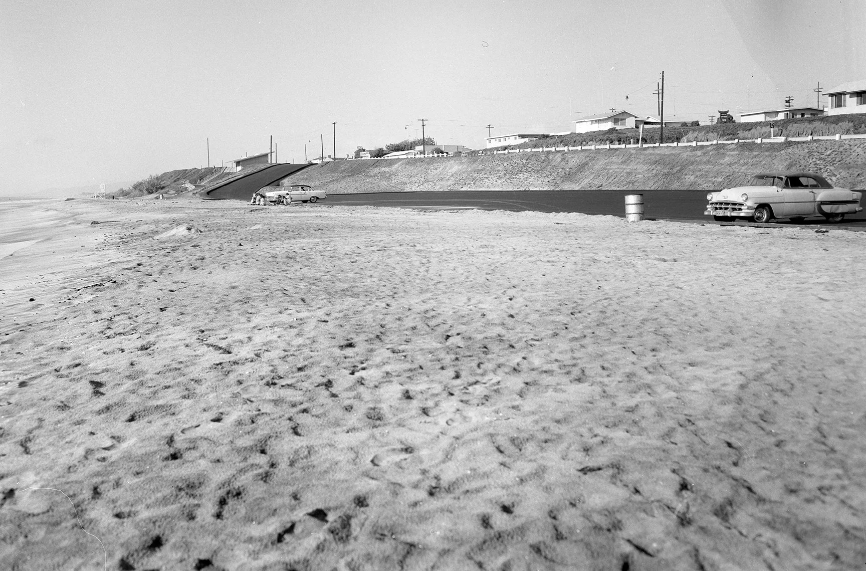
Photograph of the Tamarack Beach Parking lot from December 1959. Image via the Carlsbad Library.
And here’s a photograph from the same location from 2026:
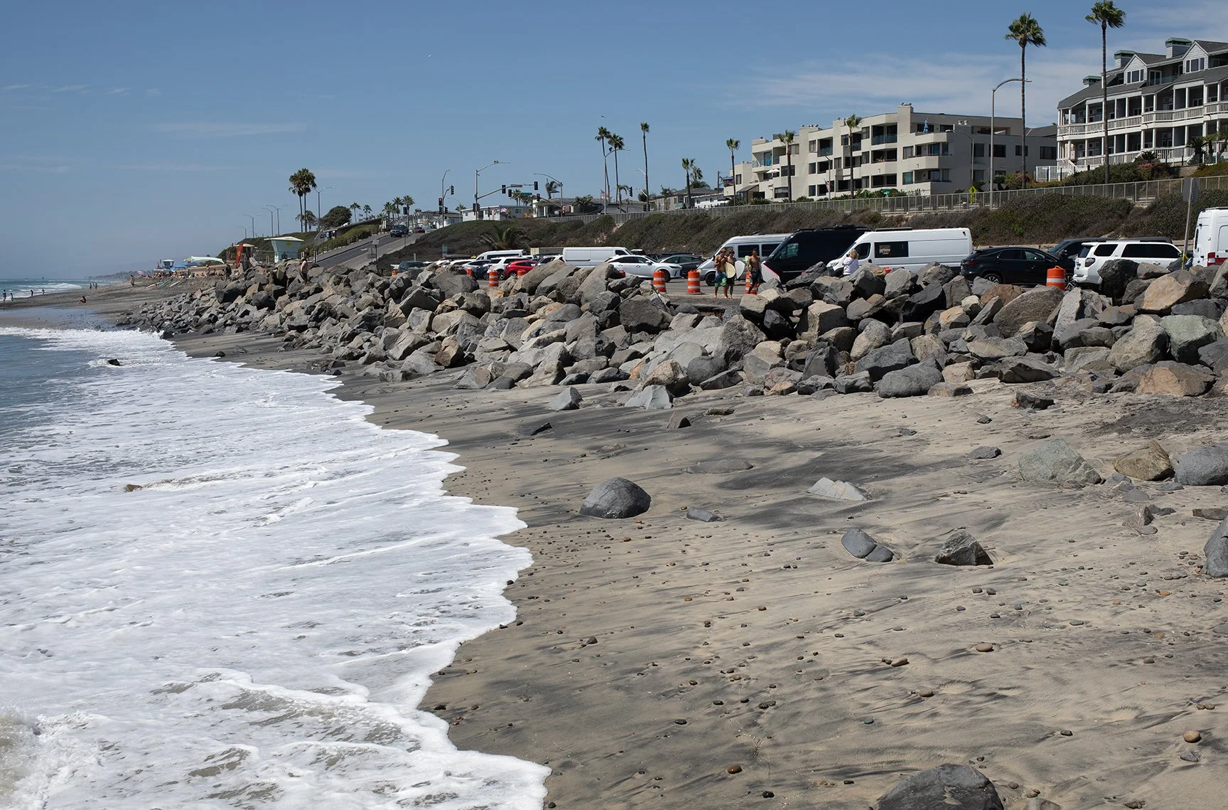
Photograph of the Tamarack Beach Parking lot from August 2026. Photo by Ryan B. Anderson.
I have the location pretty close here. Look closely at the road that comes down into the parking lot, the small building up on the cliff, and the sidewalk up on the bluffs. It’s pretty close. A few things to note: Notice the passive erosion that is happening on the beach in front of the riprap. Notice, also, how the riprap is getting pulled apart and moving around. One other thing to note is how the overall profile of the beach has changed over time. In the 1959 image, you can see the consistent slope of the beach as it progresses down to the water. If you look closely at the 2026 image, which is after the seawall and riprap were added, you can see how the replenished sand is piled up against the seawall and then drops off rapidly. I’ll see if I can find some images of how the beach looked just before this recent erosion event. There was a lot more sand on the riprap in the foreground and on the main beach in the background.