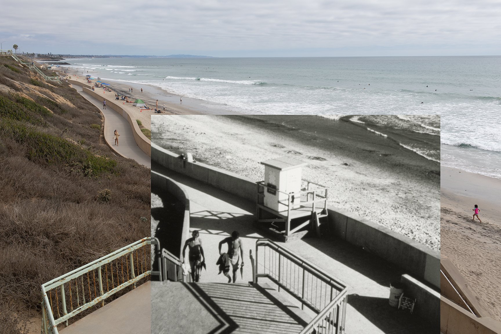
After Tamarack State Beach made the news for losing a bunch of it’s sand in the last couple of weeks, I managed to get down there for a few comparative photographs. The composite above shows a stretch of the seawall that’s at the end of Sycamore Avenue in Carlsbad. This one was pretty easy to relocate and photograph. I found the historical image, which dates to the late 1980s or early 1990s, via the Carlsbad Library:
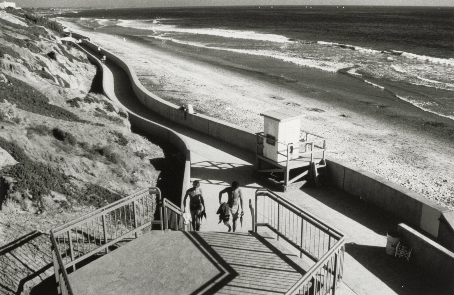
Historical photograph showing the Carlsbad seawall. Circa late 1980s to early 1990s.
And here’s the full image that I just took in August 2026:
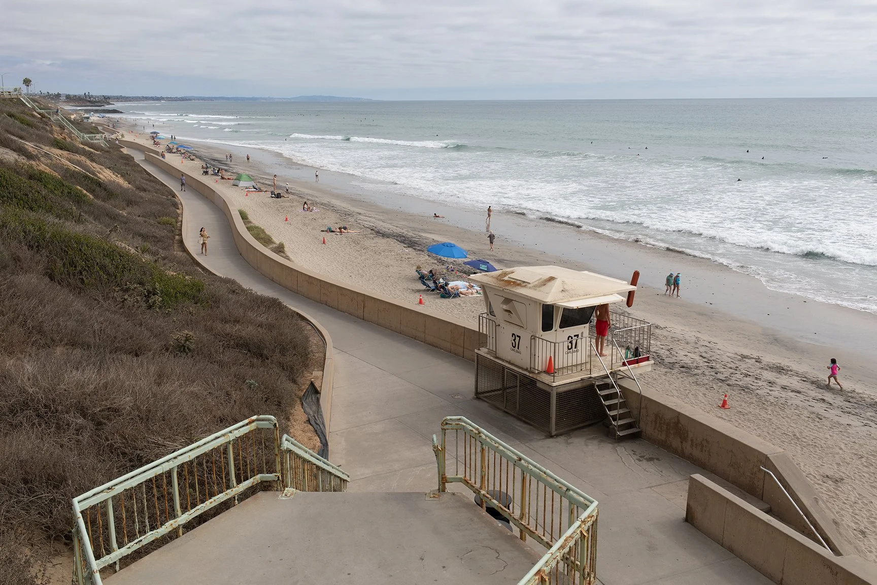
Photograph taken in August 2026 in the same location. Taken with a Canon 5D Mark IV.