
This is a photograph from the Huntington Digital Archive that I stumbled across while I was working on a recent draft for a paper about the long-term coastal histories of California. I was searching for images of Oceanside, California, which was one of the case studies mentioned in the draft, and I found this one.
It’s from the 1880s. It’s part of a small collection of photographs that someone put together after a trip through parts of Southern California. This one is titled “Near the shore after leaving Oceanside.” Since the ocean is on the right, the folks pictured in this image are facing south. If they have just left Oceanside, there’s a good chance they’re in or right around Carlsbad. Since I grew up in Carlsbad, that potential detail made me pay closer attention.
It appears to me that there’s a good chance this photograph was taken at what is now Tamarack State Beach in Carlsbad. That just happens to be the place where I spent a lot of time in my teen years (mostly surfing), so I know the place and the landscape well. Three things caught my eye: 1) the layout of the bluffs in the foreground; 2) what clearly appears to be the mouth of an estuary; and 3) the shape of the point/headland in the background.
The general layout of the bluffs and the mouth of that watershed fit how the Agua Hedionda watershed would have looked at that time. Check out this 1888 map (from here), which includes the Agua Hedionda watershed:
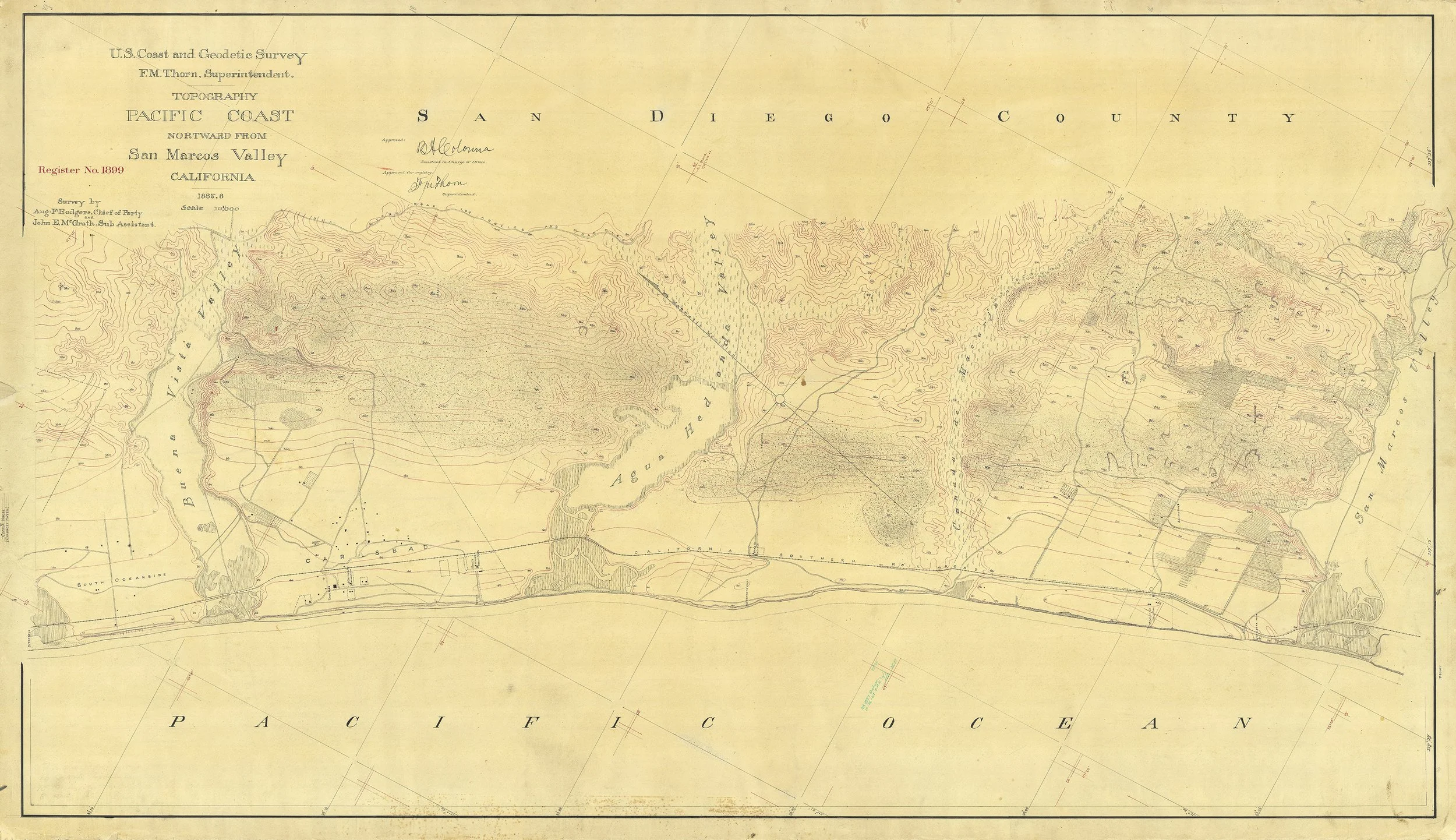
T-1899, “Northward from San Marcos Valley.” 1887-1888.
Here’s a detail of that watershed, with my estimation of where the photograph was likely taken marked by a red dot:
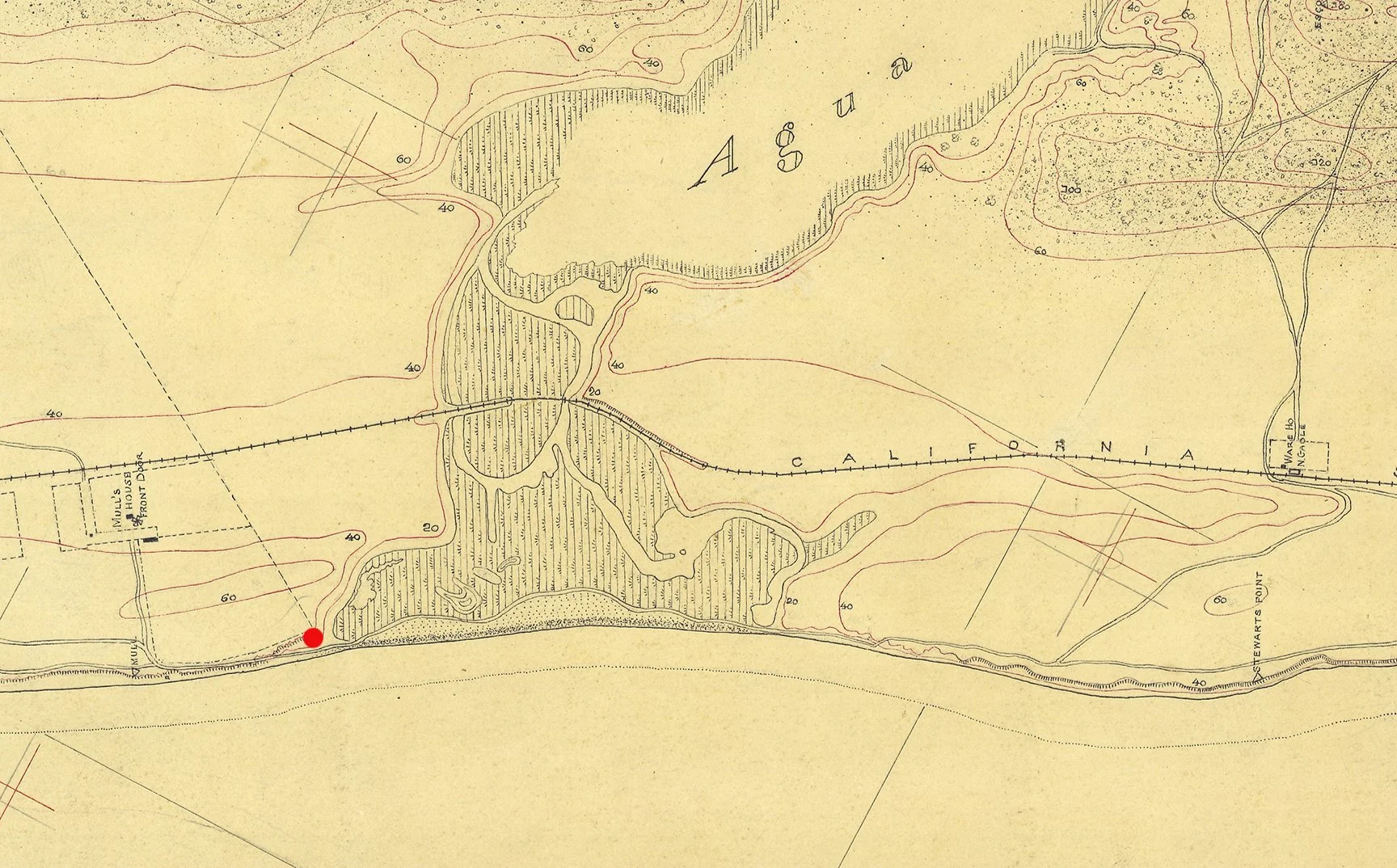
Detail from T-1899 showing possible location where photograph may have been taken (estimate).
You can see the watershed and a potential outlet/mouth on the left side. You can also see the buildup of beach in front of the estuary. Notice the road or pathway that runs alongside the inner part of the estuary, and seems to line up with the wagon pathway along the coast in the photograph. Finally, you can see the headland/point on the right side of the map detail, which also seems to fit with what we see in the photograph.
File this one in: Excellent potential location for a rephotographic site. To be continued as I look into more details about this location. Sure looks like it could be Tamarack to me!